Showing posts with label Geography. Show all posts

Monday, July 30, 2012

The Jesuits and the Indians of Baja California


Jesuits in Baja California (1683–1767)

Spanish Catholic priests called Jesuits attempted to settle Baja California beginning in 1683. They abandoned their first two attempts due to hostile responses from the natives. In 1697, Jesuits settled their first of 18 permanent missions to convert local natives to Christianity. “Along with religion, the Europeans brought with them diseases that the indigenous peoples had never been exposed to, and consequently had no immunity against. By 1767, epidemics of measles, plague, smallpox, typhus, and venereal diseases had decimated the native population. Out of an initial population of as many as 50,000, only some 5,000 are thought to have survived.” (“Spanish missions in Baja California,” http://en.wikipedia.org)

Jesuit records describe the people, lands, and culture that the Jesuits found in Baja between 1683 and 1767. These records can give us a glimpse into a people who may have been descendants of Book of Mormon people. The religious traditions of the Jesuits and the natives of Baja were similar to and different from those found in the New Testament and Book of Mormon when prophets and apostles were present about 1500 years before.

Pablo L. Martinez used Jesuit records in the early chapters of his book, History of Lower California (HLC). Several entries will refer to parts of this book that relate to the Book of Mormon.


Three Indian Tribes in Baja

The Jesuits found three prehispanic Indian tribes that they called the Cochimíes, Guaycuras, and Pericúes.  However, these were not the names the Indians called themselves. “The word laymón [or laimon] was the name” the Guaycuras or monquis gave to the Cochimíes (HLC 23–24).

We divided into two missions, and soon we noticed that there was a mingling in them of nations of different languages, one, the Monqui … and the other the Laimon. … Immediately we set about … to learn the latter, and because it is the dominating language, and appears to be the general one in this extensive kingdom, with continued study we learned it quickly, and in it we … teach the Christian doctrine to the Laimones, as in the Monqui to the Monquis.” (Herbert Eugene Bolton, Kino’s Historical Memoir of Pimería Alta, 2:50)

Was the name Laimones related to Lamonites?

Below is a map showing the locations of these three tribes (HLC 51).


Petroglyphs in Baja

The Jesuit missionaries found Indians who did not have any written records. They also found evidence of earlier people who were more cultured and skilled.

The prehispanic inhabitants of Lower California lived in a disastrous cultural condition. Certainly as the experts think, when the first men came to the peninsula they brought with them some greater culture, which was gradually lost. … There is not found among them the least notion of writing nor are there even any hieroglyphs in the land; the petroglyphs or paintings on stone that are found around Santiago … and other places do not belong according to the opinion of the learned to the men who inhabited the peninsula at the time the Spaniards arrived: they are attributed to other and very different people about whom we do not have any information except that they left their traces in these [rock] paintings. …

In the Cape Pulmo, on a large rock … there can be seen something which is like an inscription with heavy character among which many persons believe there are Gothic, Hebraic and Chaldean symbols. The natives never were able to explain the origin and significance of the drawings. They limited themselves to saying that they were the work of their ancestors. …

The petroglyphs of San Borjitas … represent distinct human figures …; in them are found as many as nine colors, without including black and white. The technique of the painters reveals great skill and beauty. …

The author of this work has seen … engravings, not paintings, of some figures of animals. The polished stone is in a convex form and on the previously prepared surface there is sculptured with a degree of perfection a deer, a tortoise and a lizard. (HLC 29–30; italics added)

The Mulekites left Jerusalem after Lehi left and lived in the land of Zarahemla which is north of where Lehi landed. Over 300 years later, Mosiah, the father of King Benjamin, found the Mulekites.

17 Their language had become corrupted; and they had brought no records with them; and they denied the being of their Creator; and Mosiah, nor the people of Mosiah, could [not] understand them. … 20 In the days of Mosiah, there was a large stone brought unto him with engravings on it; and he did interpret the engravings by the gift and power of God. 21 And they gave an account of one Coriantumr, and the slain of his people [the Jaredites]. (Omni 1:17, 20–21; [not] in verse 17 is in the Printer’s Manuscript and the 1830 Book of Mormon)

Without written records, the Mulekite language became corrupted and they no longer believed in their Creator. King Benjamin later told his sons what would have happened if Lehi had not brought the plates of brass to the new world.

Were it not for these things … even our fathers would have dwindled in unbelief, and we should have been like unto our brethren, the Lamanites, who know nothing concerning these things, or even do not believe them when they are taught them, because of the traditions of their fathers, which are not correct. (Mosiah 1:5)

Indian beliefs about God

The Jesuit missionaries asked the three Indian tribes about their religious beliefs. Some Indian beliefs are similar to Christian beliefs while others are similar to LDS beliefs. Some believe the Indian beliefs were influenced by the Jesuits, “but considering the limited intelligence of the [Indians], such a conclusion is impossible to accept” (HLC 57). However, if the Indians were descendants of Book of Mormon people, we would expect some similarities to Old Testament writings found on the brass plates, and to Book of Mormon writings. We would also expect differences that would come after 1500 years without prophets or written records. In the examples below, notice the similarities and differences. (Underlining added, but italics are in original.)

“The Pericú tradition mentioned a great lord who lived in the sky, called Niparaja, who had made the sky, the earth and the sea, and who enjoyed the privilege of going whatever he liked. This great personage had as wife Anajicojondi, who gave him three sons without use of herself, since she lacked a body; one of them Cuajaip, had been a real man and had lived for a long time on the earth … to indoctrinate humanity. One day these people ungratefully rebelled against the one who had granted them innumerable blessings; they killed him and placed on his head a wreath made of thorns. They believed that in the sky there were more people than on earth, and that in that region at a remote period frightful wars had been fought, provoked by another personage called Tuparán by some and Bac by others, against the supreme Niparaja; that the latter had been victor in the end … [and cast Tuparán] from the sky with all his followers.” (HLC 57–58)

“The Guaycuras gave credence to a leading spirit called Guamongo, who sent diseases to earth. They asserted that at a remote period he had sent to the earth one of his [subordinates] called Gujiaqui, to visit there in his stead; it so happened that as he traveled through the Peninsula, sowing pitahayas [= tall cacti or their edible fruit] and establishing fishing localities, at the end of which he hid in Puerto Escondido, where he was served by lesser spirits, who took to him daily exquisite pitahayas and delicious fish to eat, he busied himself making capes for doctors and charlatans; and that he then went back to the north, from whence he had come.” (HLC 58)

The Cochimíes … made reference to a great lord who lived in the sky, called … He who lives; they spoke also of his son, born without the aid of woman. … There was only one [Lord], creator of the sky, earth, plants, man and woman. They agreed that He who lives created certain invisible beings … [who] plotted against him, declaring themselves enemies of man; and that these being were liars and seized men when they died and put them under the earth where they could not see He who lives. … They made mention of a man who in far distant times had come from the sky to benefit mankind …; but they were not able to say what benefits he had brought to man nor did they tender him any worship. … They celebrated a fiesta named for the man who came from the sky, but this … was reduced to the enjoyment of pleasures, eating and dancing. (HLC 59–60)


Cochimí Indian names for God

The Cochimíes … made reference to a great lord who lived in the sky, called in their language He who lives; they spoke also of his son, born without the aid of woman, and who had two names: one of these names signified The Swift One and the other Perfection or the End of Clay; furthermore, there was another personage, He who makes Lords. (HLC 59)

The name “He who lives” is related to scripture phrases: “the living God” (Josh 3:10; Dt 5:26; 2 Ne 31:16) and “the LORD liveth” (1 Sam 14:39; 2 Sam. 22:47; 1 Ne 3:15). The Jesuits like other Catholics believed in a God without body, parts, and passions. However, for Moses and Book of Mormon prophets who saw and talked with God “face to face” (Ex 33:11), “the living God” was in contrast to idol gods “which neither see, nor hear, nor eat, nor smell” (Dt 4:28).

The first name of the great lord’s son, “The Swift One” relates the following scriptures.

The LORD … rode upon a cherub, and did fly … upon the wings of the wind (2 Sam 22:7, 11; Ps 19:10). The LORD rideth upon a swift cloud (Isa 19:1). [Jesus] was taken up; and a cloud received him out of their sight (Acts 1:9). Jesus Christ … cometh with clouds (Rev 1:7).

They saw a Man descending out of heaven (3 Ne 11:8). There came a cloud … [and Jesus] ascended into heaven (3 Ne 18:38–39).

The other name of the son, “Perfection or the End of Clay” is interesting. Christ did not say he was perfect until after his death and resurrection (Mt 5:48; 3 Ne 12:48). The Bible says “the LORD God formed man of the dust of the ground” (Gen 2:7). King Benjamin said, “the Lord Omnipotent … shall dwell in a tabernacle of clay” (Mosiah 3:5). In “the resurrection … this mortal body is raised to an immortal body … that … can die no more; their spirits uniting with their bodies, never to be divided; thus … becoming spiritual and immortal” (Al 11:45). Therefore, after the “end of clay” or the mortal body, Christ was the first to be resurrected and to be perfect or complete with an immortal body that can die no more.

The last name, “He who makes Lords,” will be discussed in the next entry.


“He who makes Lords”

The Cochimíes … made reference to a great lord … called … He who lives; … furthermore, there was another personage, He who makes Lords. (HLC 56–59)

The name, “He who makes Lords,” makes sense to Mormons but not to most Christians. The Jesuits who like other Catholics of the time used the Latin Bible instead of the Hebrew Bible. A common Bible name for the Creator (Gen. 2:4) is “LORD God” in English, and “Dominus Deus” (LORD God) in Latin. This name seems completely unrelated to “He who makes Lords.” The same name for God in the Hebrew Bible is “YHWH Elohim” (Jehovah Elohim). Hebrew was the language of the Jews and the Nephites (Morm. 9:33).

Elohim is plural and means Gods or gods. However, in the Bible it is translated as God when it refers to the God of Israel and gods when it refers to pagan gods.

YHWH is written without vowels. The vowels added in modern Hebrew Bibles are from the word adonai (Lord) to remind readers to say adonai instead of what was written. Christians used the word Jehovah based on these vowels, but usually translated it as LORD in the King James Bible. Scholars generally write Yahweh and agree that YHWH comes from the Hebrew word meaning “to come into existence, become, be,” but they differ as to the meaning. For many scholars, YHWH means the one who is, the existing, ever-living. However, many recent scholars believe it is the causative form which means: The one bringing into being, life-giver; giver of existence, creator; he who brings to pass, performer of promises. Examples of the causative meaning of YHWH include:

The LORD of Hosts (1 Sam 1:3): “he creates armies”

Jehovah-shalom (Jg 6:24): “he creates peace or well-being”

Jehovah-nissi (Ex 17:15): “he creates my refuge or standard”

Therefore, YHWH Elohim (LORD God) would mean: “he creates Gods,” “he will create Gods,” or “he who creates Gods.” The Cochimi name, He who makes Lords, reflects this Hebrew meaning.

 
Sources:
  • The Brown-Driver-Briggs Hebrew and English Lexicon
  • Theological Dictionary of the Old Testament, 5:500–501, 515
  • William H. Brownlee, “The Ineffable Name of God,” Bulletin of the American Schools of Oriental Research (April 1977), 39–40.

Author of this paper:
  Monte F. Shelley, PhD
  Director, Research Technology Group
  Maxwell Institute of Religious Scholarship
  Brigham Young University


Travel to San Borja (Bountiful)

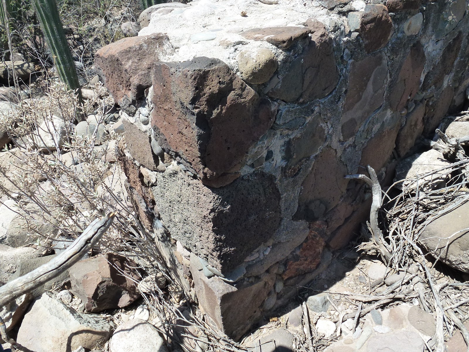
We decided to try to get to San Borja again, and hit it this time. Perhaps this is a potential site for Bountiful. We found walls, roads, a variety of fruit trees (including olives) as well as pottery shards. Again the vegetation was dense and interesting. A young man who works with INA (something like Instituto Nationale Anthopoligia—he is working on a dig at El Arco; Zach, I think this may be a good connection for us [his bosses at least]) walked us around indicating which things were Jesuit, Dominican, and pre-Jesuit. He maintains that many of the walls and roads were pre-Jesuit. There were cold springs and hot springs that were “cribbed” with rock and which I will attach pictures for with this email. (Kevin, my last email with images bounced back, so I don’t think you got them). I also took some video I can show at our next meeting.
Whether or not this is Bountiful, we certainly came away from what I now consider the most interesting site I have seen so far in the project. I took olive, pomegranate, grass, and bamboo samples for Rickmael. Kent, I think you would have had a heyday with this one! They are growing grapes, lemons, date and blue palms there as well. Lots of mounded earth and rock walls to inspect as well (One image I will include shows a section of wall that came down three weeks ago with an earthquake they had in the area). Water catchment systems that our young INA fellow thought were pre-Jesuit too . . . Zach, I think we need to get you there one way or another.

This is ATV country with super-washboardy roads that go inland 22 miles from the west (Mex #1 hwy-lots of room to park vehicles) or about 20 from the Bahia de los Angeles highway (not so much room to park vehicles). Linda actually found a pottery shard as we were walking and surrendered it to the young man. I’ll include images of those shards too. He had a piece of respaldo that looked like a cutting edge. He also had a large stone jug about 18 inches in height. He had made some others himself from the same kind of stone, but indicated this smaller jug was original to the area.

Anyway, you can see that we got excited about San Borja and think it is a worthwhile place to spend some time. Check out the pictures


Travel to San Ignacio (Zarahemla)


We went to the head of the lagoon where the irrigation canal begins and came back full circle into San Ignacio. We also went over to the west side where we climbed the big hill (and I was attacked by a cactus) back in November, but this time rode around San Lino (west side of town) and inspected the 3-foot high, 3-foot wide stone wall that is found on the west side of the river. (It looks like a long dark line on Google Earth, across the river from the Desert Inn where we stayed.) We took back roads from the west side all the way back to the Desert Inn again, crossing the river at the same spot that Kent, Otis Sr. and I did (after I had been half-baptized in Sidon!). It was very interesting to have covered so much ground with the ATV in a few hours in one day, but it gave me an appreciation of how much better we could get around using such vehicles.

We did not go further downstream before we decided to head back northward. Our brake problem that occurred last week meant that we skipped Bahia de los Angeles, so we decided to head back in that direction. Linda has been significantly traumatized by the narrow roads (not to mention my“inventive” driving), so we will not get over to Santa Rosalita or Loreto/San Javier this trip. However, I am determined to get their sometime in the next year . . .

Tomorrow we will get to Bahia and then down toward Bahia de Animus to look at a potential military outlook near the narrow neck. It was identified by the Erhle Stanley Gardner (the Perry Mason originator with a helicopter) group back in the 1960’s. Should be interesting.


Saturday, July 28, 2012

Blog Site Introduction


This blog exists to support www.achoiceland.com and its "Approach to the Book of Mormon Mormon Geography" proposal. Monographs, articles, essays and scriptural insights related to this proposal will be posted to this blog.

All comments to this blog will be reviewed before they are made public. This is not to stifle criticism, but rather to ensure a high level of deportment in the communication.

Map of Baja and Sonoran Desert with Indigenous People


This is a map of the Baja Peninsula and the Sonoran Desert showing the historic distribution of the indigenous peoples of the area. Of special note is the group with the number 23 - Cochimi (Laymon).
Names of indigenous peoples
(with number code to the map)
1 Western Apache; 2 Yavapai; 3 River Pima; 4 Tohono O’odham; 5 Hiá ced O’odham; 6 Maricopa; 7 Kavelchadon; 8 Quechan; 9 Halchidhoma; 10 Mohave; 11 Kamia; 12 Cahuilla; 13 Cupeño; 14 Northern Diegueño; 15 Southern Diegueño  (Kumeyaay), Tipai; 16 Cocopa; 17 Paipai (Akwa’ala); 18 Kiliwa;  19 Ñakipa; 20 Cochimi (Borjeño); 21 Cochimi (Ignacieño); 22 Cochimi Cadegomeño); 23 Cochimi (Laymon); 24 Cochimi (Didiu); 25 Cochimi (Monquí); 26 Guaicura; 27 Callejue; 28 Periúe; 29 Aripe; 30 Huchiti; 31 Cora; 32 Pericú; 33 Isleño; 34 Seri; 35 Yaqui (and Mayo combined under the name Cáhita); 36 Pima Bajo; 37 Guarihio; 38 Eudeve; 39 Ópata; 40 Mountain Pima; 41 Tarahumara; 42 Mayo; 43 Tepehuan; 44 Jano;45 Chiricahua Apache; 46 Zuni; 47 Hopi; 48 Navajo; 49 Havasupai; 50 Hualapai; 51 Chemehuevi; 52 Shivwit; 53 Southern Paiute; 54 Timbisha Shoshone; 55 Panamint; 56 Kawaiisu
Modified from Goodwin 1942; Massey 1949; Shreve 1964; Ortiz 1983; Fowler 1995; Rea 1997.

The location where the Laymon tribe was located corresponds to the land of Amulon / Helman in "An Approach to the Book of Mormon Geography" (see the "Lands ot the Book of Mormon" map).

Locations in Baja We Need to Visit


In his book "The King's Highway in Baja California", Harry Crosby, mentions finding two very interesting road sections high in the mountains south-east of San Ignacio and south-west of Santa Rosalia (see arrow on the map below for the approximate location). I hope that someday we can locate and document these two locations.

Starting on page 88 we read:


"After a series of sharp and confusing rises and turns we arrived on San Venancio summit at an elevation of 3500 feel. There, quite unexpectedly. we had the most magnificent view of the trip thus far. Without our being aware of it we had ridden to the last eminence at the north end of the Sierra de Guadalupe. From our position on a ridge we had a 180 degree angle view to the north. Below us to the east was a trail winding down to EI Rincon. a rancho. As I understood from Howard Gulick's study of EI Camino Real, he took that trail to be the Cuesta de San Venancio. Beyond, in that direction we could sec the waters of the Gulf. Across our view to the north ran the jagged transverse Sierra de Santa Lucía. Pecking just over the top of that range, but much more distant. was the tip of Cerro de la Vírgen, the tallest of the Tres Vírgenes volcanoes at 6500 feet. Between us and the Santa Lucía range was the Arroyo de Santa Agueda which ran of to the east, ultimately to flow into the Gulf of California just south of Santa Rosalía.It was too much for us to take in all at once. We unloaded the animals which had worked hard to get us up there, then took out maps, old trail accounts and binoculars. I will never forget the thrill and satisfaction it was to be in that place. We had come over a hundred miles from our uncertain start at Loreto, our travel scheme was working at last and perhaps for the first time I really began to feel the scope of EI Camino Real as it once was, and to realize how utterly it differed in every way from any of the lowland routes then in common use.

Up to that point I had considered the whole expedition as an exciting job to be finished so that I might go on to others. I had been so beset with the necessity to make arrangements and to solve problems that I had not really kept things in perspective. Also, in a mere physical sense we had been ploughing across, a broken and confused landscape where we could seldom see any horizon. Somehow. standing on that historic summit and looking out on that wildly colorful volcanic landscape, the course of things was altered for me. I did not really think about such things at the time, but since then I have felt that something important begun there.
While Paul and I were communing with our larger surroundings, Guillermo was off scouting. None of us liked the idea that the trail to EI Rincon was our route. It was uncharacteristically narrow and winding and most roundabout for a Jesuit road. Presently Guillermo returned and said he had found the actual old road at a point farther northwest. We followed the ridge some distance from our lookout point until our guide stopped and pointed. Below was a steep descent north-northwest down a draw between two rocky outcroppings. No sign of a trail could be seen. but Guillermo led on. Soon he pointed to unmistakable showings of the old road and we were soon on what proved to be the most beautifully built and preserved cuesta on all of EI Camino Real. Down at least nine hundred feet of elevation, we zigzagged back and forth on that precipitous bajada. No one had passed that way for so long that the path was entirely blocked by growth, and the thorny natives had to be hacked out of our way at every step.

We were led along and beguiled as we went by the old construction on which we trod. It had been cut about three feet wide into the stern stuff of the hillside. Where necessary, walls had been built to retain sections of trail. The turns at the ends of the switchback were shored up by rock construction and all of it was so well done that it had continued to do its appointed job for two hundred years. We marveled at it all the way down. Under the bushes of that slope could be seen a minor but fascinating piece of history. It should be recognized and preserved as long as people care to celebrate the spirit of its builders.


. . .
A Curious Encounter
At the foot of the cuesta we struck off to the northwest down a ridge. Out in the valley in front of us we could see a clearly marked road or trail bearing more northerly than our route. We speculated about it but decided it was headed too far north. That proved to be a mistake as we learned later. Soon the ground became fairly level at 1500 feel below San Venancio summit, where we intersected a well -maintained auto road. According It, Howard Gulick's notes, that should have led to Rancho Candelaria. His version of' El Camino Real continued over a ridge from there to a place called Santa Cruz, where Father Serra had arrived at midday from Guadalupe. We followed the road and soon passed a left turnoff to a rancho called Las Higueras. On the slope of the sierra above the ranch we could see the reason for the name, There was an obvious source of water and a number of large trees, including several of the giant zalates.

Once we were under way again we faced a formidable obstacle, Cuesta de Candelaria. It was the twin of the Cuesta de los Angeles for steepness and difficulty and required an hour and a half to negotiate its thousand fed. As we made the harrowing ascent I realized how much I had learned and how much I had come to trust mule's agility and good sense.

One thing puzzled us. Since leaving the foot of San Venancio we had not seen any good showings of the old road. We had assumed that the auto road overlaid part of it, but now that we had left it behind there was still no sign. Not once on the cuesta nor indeed at the top did we see a sign that we could interpret as El Camino Real. The only explanation we could find was that the road we had seen going farther north was the correct trail.

At the top we paused a few minutes to rest the beasts and enjoyed a wonderful view to the east. Then we started down the far gentler slope on the other side. In a few minutes we came to one of the great surprises of our trip. Out on that high and deserted valley leading apparently from nothing to nowhere was a wide and massive road hand-made of rocks carefully laid in a pattern of almost Roman sophistication. It appeared from behind a mountain below us. carved deeply into its flank, and charged up the slope on which we stood. Above us it curved over a ridge and disappeared from view. It appeared old but was in marvelous condition, far better than any piece of Jesuit road that we had seen. Paul and I stopped our mounts and gaped at the bewildering sight. Guillermo joined us, and even though he had never been there before, he recognized the work well enough to suggest what proved to be the correct explanation. He said it must be the work of La Compania, properly called EI Boleo."


Friday, July 27, 2012

Scholarship and the Book of Mormon

Because I was raised by active LDS parents, I was exposed to the Book of Mormon at a very early age. The strange language structures of the book just seemed natural to me – that was just the way scripture was. It wasn’t until I was a college student that I learned enough to appreciate just how different the language of the Book of Mormon was.

About 30 years ago I first read an article about Hebraisms in the Book of Mormon (see“Hebraisms in the Book of Mormon: A Preliminary Survey”, BYU Studies, 1970, Vol11:1 – available online). I finally understood why the English of the book was so different. The knowledge I gained from reading this and similar scholarship changed my ability to study and understand the Book of Mormon.

The next major influence that helped me better understand the Book of Mormon came in about 2003 when I attended a seminar in the BYU College of Humanities given by Dr. Royal Skousen. He proposed that the revealed Book of Mormon translation given to Joseph Smith by the “gift and power of God” included many words, whose meaning as used in the Book of Mormon, came from Middle English (15ththrough 17th centuries - I refer to this as Archaic English). I became a frequent user of the online Oxford English Dictionary because of its priceless historical data on the English Language (see Appendix: Oxford English Dictionary, below). Every time I see a word that seems unusual, I consult the OED online and dozens of times I have found that old meanings of words fit the Book of Mormon context much better than contemporary or 19th century meanings.
In November of 2008, I was invited to a special presentation by my brother, Dr. Lynn A. Rosenvall (PhD in Geography) and his son David L. Rosenvall (MBA, BS in Engineering, David has considerable experience with internet systems) concerning their work on the Geography of the Book of Mormon. As Lynn said at the time: “the story had to take place somewhere.”Their proposal that Baja California was the site where the Book of Mormon record keepers lived was both stunning and startling to me personally. For years I had believed the story might have occurred in Mesoamerica; however, I knew there were serious challenges matching that location to the story contained within the Book of Mormon. Just two of many challenges were climate mismatches and scale mismatches.

Most satisfying to me personally was the match of their Baja proposal to the Archaic English meanings of Book of Mormon words as proposed by Royal Skousen. Time after time Lynn and David found that geographical terms as used in the Book of Mormon match with the old meanings of words (e.g. OED: isle or island: “a piece of land completely surrounded by water but formerly used less definitely, including a peninsula… see Book of Mormon | 2 Nephi 10:20, “we have been driven out of the land of our inheritance; but we have been led to a better land, for the Lord has made the sea our path, and we are upon an isle of the sea.”)

Because of all of this, I will post articles to this blog dealing with all three subjects: Language (including insights about Hebrew), Archaic English in the Book of Mormon, and research related to Baja and its geography.


In the Book of Mormon Ether 6:10 we read (emphasis added) “And thus they were driven forth; and no monster of the sea could break them, neither whale that could mar them; and they did have light continually, whether it was above the water or under the water.” With the usual meaning of damage, destroy or blemish, this verse make little sense. However, notice the OED entry for mar. An old meaning of the word is “hamper or hinder”, and it appears that this meaning is being used in the Book of Mormon.


Thursday, July 26, 2012

Fevers and seasons in Baja and the Book of Mormon


1.       Fevers occur in many places around the world, especially in warmer climates, and not just in Mesoamerica.

2.       Malaria is not the only fever that can cause drastic consequences such as death.

3.       Malaria is not the only fever that can be controlled or ameliorated by "plants and roots."

4.       Dengue fever appears to be more widespread than Malaria, and occurs in tropical and semi-tropical climates.  It is endemic in 110 countries. Dengue, like Malaria, is borne by mosquitoes.  See this web link:  Dengue fever - Wikipedia, the free encyclopedia.

5.       Baja California has long had a problem with Dengue fever—in the past as well as today.  See these web links: Dengue Fever in Baja – The Facts  and Hemorrhagic dengue alert in Baja California Sur, Mexico | NowPublic News Coverage  and Viva La Baja! Blog  for a few web pages on the topic. There are other web sites.  Just search for "dengue fever baja."

6.       The bottom line is that the occurrence of fevers in Baja California fully matches the account in the Book of Mormon (Alma 46:40):

“40 And there were some who died with fevers, which at some seasons of the year were very frequent in the land—but not so much so with fevers, because of the excellent qualities of the many plants and roots which God had prepared to remove the cause of diseases, to which men were subject by the nature of the climate...”
7.       The account in Alma 46:40 more fully matches the climate situation in Baja California than it does Mesoamerica.  The wording says "fevers, which at some seasons of the year were very frequent in the land…" As we know, the Mediterranean type of climate in Baja California has two seasons (wet and dry) which affect the time of year when fevers would occur, whereas most of Mesoamerica has only one unvarying season throughout the entire year.  Clearly the Book of Mormon account mentions seasons and changing climatic conditions for the development of fevers.


Wednesday, July 25, 2012

Map of the Distribution of Uto-Aztecan Languages


The map is from a hand-out of Brian Stubbs given out at a seminar at Brigham Young University in 2010.


The Abbreviations of the Uto-Aztecan Languages (used in the above map)
Western Numic (WNum)
Mn (Mono)
NP (Northern Piute
Hp and Tb are each a branch
Hp (Hopi)
Tb (Tubatulabal)
Corachol (CrC)
Cr (Cora)
Wc (Huichol)
Central Numic (CNum)
TSh (Tümpisha Shoshone)
Sh (Shoshoni)
Cm (Comanche)
Takic (Tak)
Sr (Serrano – Takic)
Ls (Luiseño – Takic)
Cp (Cupeño – Takic)
Ca (Cahuilla – Takic)
Ktn (Kitanemuk – Takic)
Tara Cahitan (TrC)
Tbr (Tubar)
Yq (Yaqui)
AYq (Arizona Yaqui)
My (Mayo)
Wr (Guarijio)
Tr (Tarahumara(
WTr (Westrn Tarahumara)
Eu (Eudeve)
Op (Opata)
Southern Numic (SNum)
Kw (Kawaiisu)
Ch (Chemehuevi)
SP (Southern Paiute)
WMU (White Mesa Ute)
CU (Colorado Ute)
NU (Northern Ute)
Tepiman (Tep)
PYp (Yepáchic Pima)
TO (Tohono O’odham)
PB (Pima Bajo)
NT (Northern Tepehuan)
ST (Southern Tepehuan)
Aztecan (Azt)
CN (Classical Nahuatl)
Pl (Pipil)